December 5
Silver-Days
Grizzly Gulch to east pass of Silver Fork, descending. Up to the west bowl of Silver Fork ridge, descending Hideaway park into Days Fork, continuing out to Spruces.
Elevations, slope angles and aspects:
7300-10200', angles to around 40°, all aspects.
Avalanche activity:
Starting zone of the east Silver slide, last Saturday. This is the eastern edge. The slide propagated west taking out steep pockets over to Over Easy.
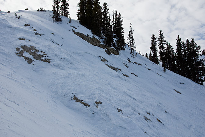
A warm day produced wide spread rollers yesterday on all aspects, including north facing.
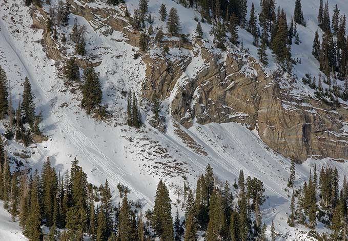
The slide from Saturday in the north facing shoulder of the west bowl of Silver area. Much of the terrain to the east had a shallower crown from a natural running earlier, probably during the storm
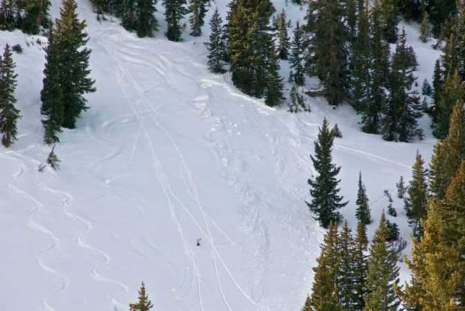
A crack at the top of Hideaway park entry into Days Fork. Two ski cuts initiated a long running crack,
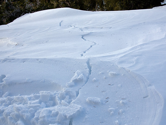
which also produced cracks all the way across the skier's left main chute.
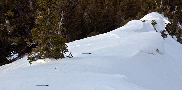
Following the sub ridge down, a recent natural was found in the Hideaway area, west of the main chutes.
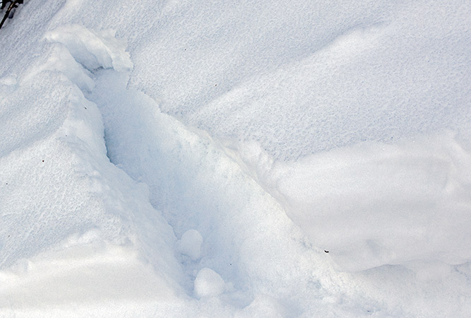
The path of the slide.
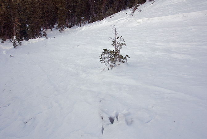
Large rollers coming off the rocks stressed the slope enough to trigger a slide in the gully.
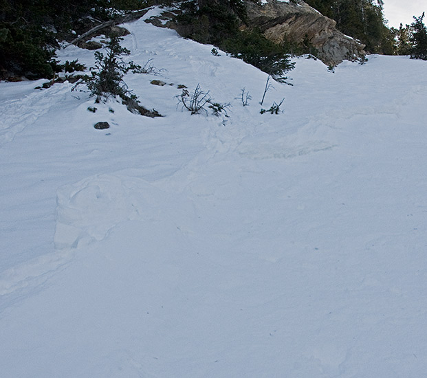
It was about 40' wide, with the wind loaded side over a foot deep. Shallow side, without loading, was only 5-6", initiating on the facets just under the recent snow.
The slide ran about 500' vertical, trenching into older layering because of yesterday's warm temperatures.
No other activity was observed
Slopes skied:
East bowl of Silver and Hideaway park.
Snow conditions:
Most snow surfaces had a melt freeze crust from yesterdays warm temperatures and overnight cooling. Those crusts were variable in thickness, dependent on aspect and were found even on sheltered upper elevation north facing. There was some damp powder? found in a coupla places where the crust was just a zipper. Few and far between, the majority was breakable and thicker. Snow at lower elevations and in sun exposed was melting.
Evaluation:
Current conditions are a mixed bag. No collapsing was felt, probably the result of good settlement from mild temperatures. Areas where unstable snow remains are probably localized, but not non-existent, as was discovered in Hideaway. The current weather forecast indicates a good storm for the weekend, with amounts in the 1-1.5" of water weight. I'd expect another round of avalanche activity on the same layering as the last one. Slides will be likely be larger and wider, some stepping down into older snow layering.
© wowasatch.com